
Hong Kong – West Kowloon Reclamation
In the mid-1800’s, Victoria Harbour was about 2 km wide. Back then the city was a collection of small colonial buildings. Shanty towns exploded into existence in the post WWII era due to massive influxes of refugees fleeing war and the communists. There was a huge need for scarce land, so the city became built up into the highrise haven you see today, and expanded into the harbour. Various reclamation projects at various points and especially on Hong Kong Island have narrowed the harbour quite a bit so that it is now half of what it used to be. The water is quite polluted as 1.5 million litres of raw sewage are poured into it daily.
CULTURAL NETWORK – world cultural center
Hong Kong is a ‘land hungry’ place and, from the early days of development, has had to rely heavily on reclamations to satisfy growing needs for more housing, community uses, port activities and other economic need.
Initially, reclamation was formed principally around Victoria Harbor. Waterfront development in Hong Kong has a long history. In 1984, it was estimated that some 33 square km of land had been added to Hong Kong’s land area by waterfront reclamations since 1841. This did not take into account major land use change through the redevelopment of existing waterfront locations. Since 1984, the amount of reclamation in Hong Kong is equal to all the reclamation done in the city from 1945.
Faced with a continued expansion in population over the next 15 years, growing expectations for better and more spacious living and working environments, and the development of Hong Kong as a regional hub, the needs for more land for various kinds of activities will continue to grow steadily in both scale and diversity.
In this context, there is a need to move ahead in a considered way with the design evolution of potential new harbor reclamation sites, each of which has a key role to play in support of the development of Hong Kong’s hub functions and also to facilitate the restructuring of obsolete parts of the Metro area. Now that large areas of proposed reclaimed land are beginning to appear in various locations around the harbor, there is a growing awareness of the significant changes taking place.
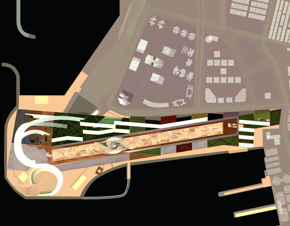
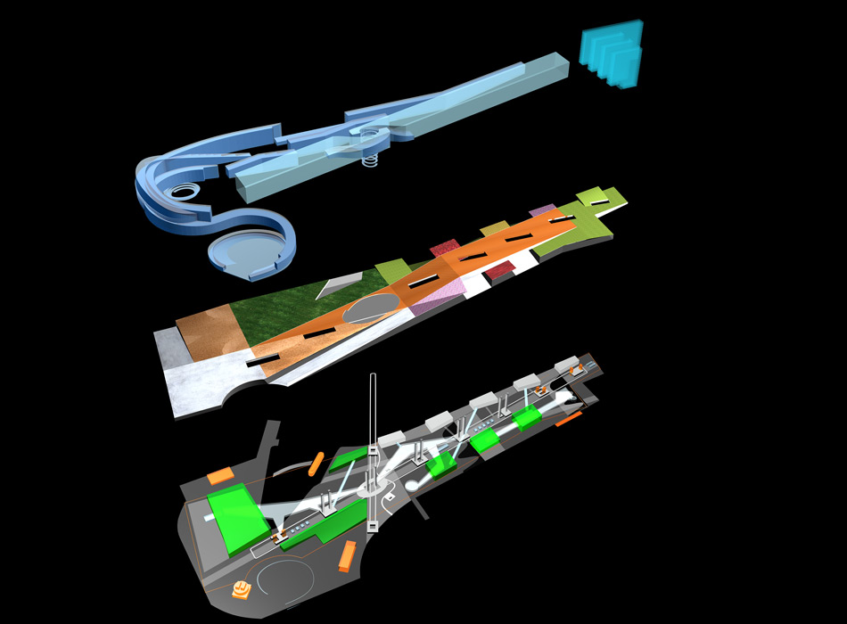
CITY LAYERS
The program is structured in 3 main layers:
- Liquid city
- Open space
- Infrastructural space
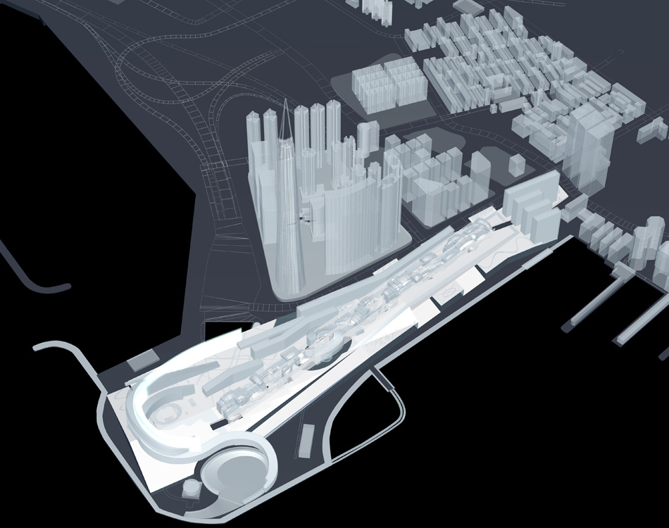
MASTER LAYOUT PLAN
Our proposal is based on the idea of the city, which is all over you at the same time: up and down, left and right, forward and backward, with the different quality of urban sequences.
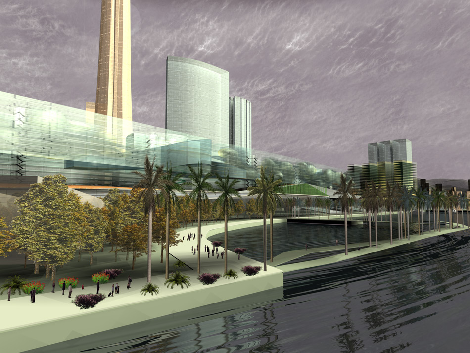
The previously planed park is shifted from the site level to approximately 24 meters in height. Its border defines the boundaries of the infrastructural layer (including parking, vertical and horizontal transportation and pedestrian ways and all basic urban facilities necessary for any functional city part), which should be support space for any construction form that the city above may take in the future. As the outside extension of it there is a waterfront promenade, wood areas, open-air arena, etc.
The second layer is an open space urban landscape which is not designed in terms of architectural forms or buildings, but as programmed surfaces of different textures (mineral and wooden materials, grass, thematic gardens) based on possible leisure activities and events. It can be freely accessed from any level and occupied by citizens in unforeseen ways.
As an endless stage, it provides, at the southern side, a 1.5-km-long panoramic view of the sea and of the northern side of Victoria Harbour, and at the same time optimizes the microclimate.
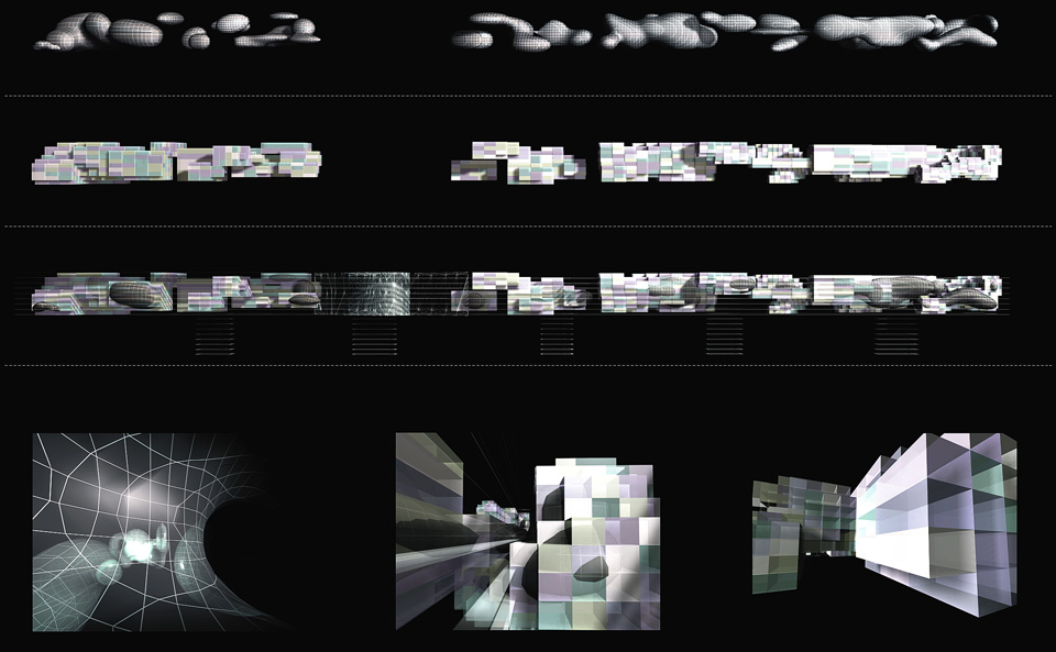
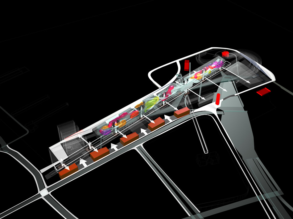
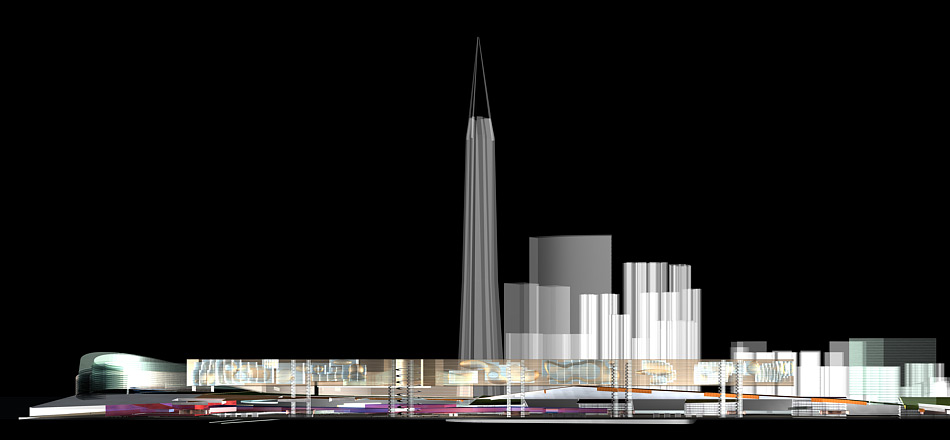
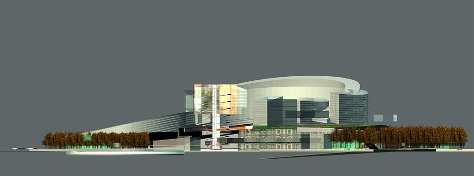
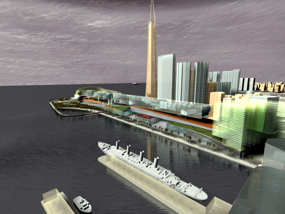
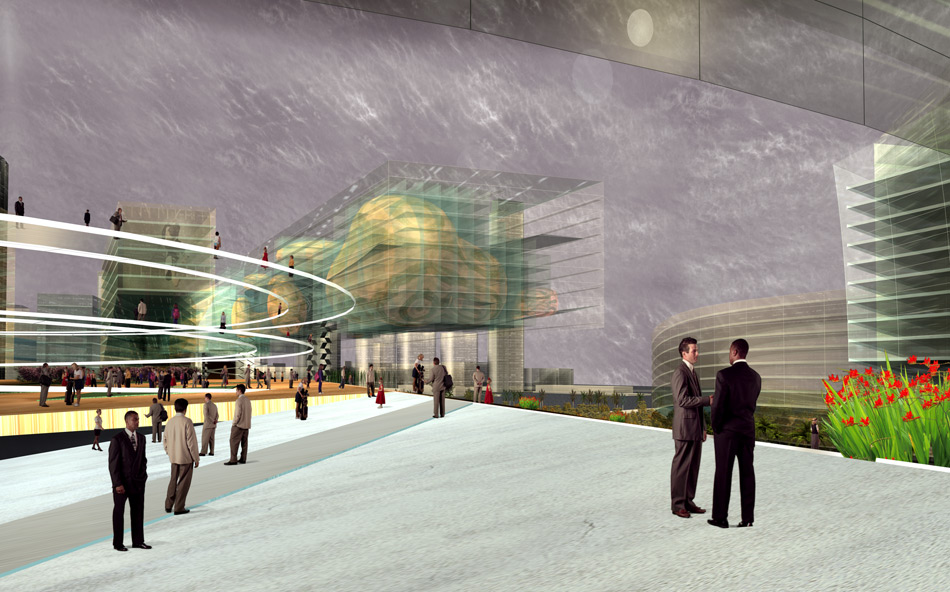
The liquid city floats above the described surface and it is a proposal for a possible development of the built-up structure, denying the traditional way of perceiving figure-ground relationship. It is considered as a frozen “flow” condition of parametric simulated design process, which leaves the system open for further changes and improvements. The only urban regulations are to consider the program (media center, entertainment, museums, theaters, etc.) and the woven edge condition of the over-built space, with the purpose to orientate and open the site toward south.
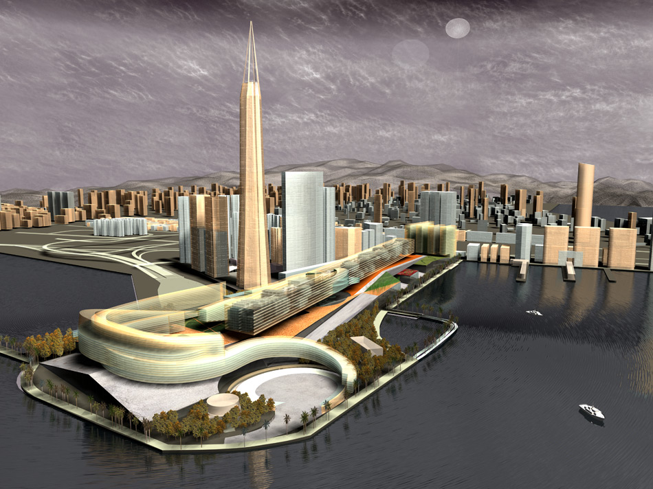
The additional and/or extra part is the gigantic horizontal block exactly 1 km long, which “touches” the surface only at one point. It is the WORLD CULTURAL CENTER and incorporates more then 22 nations from all over the world. This universal and global container is filled with program based on a specific culture each nation can bring to Hong Kong. The main impact of each culture is its art, music, traditional festivals, food and cooking, and all the rituals (way of life) connected to this activity, so that this element can be considered as the world’s biggest kitchen of art and culture, with all supportive functions.
It establishes itself not in terms of another addition to the Hong Kong skyline, but defines a new symbolic and iconographic horizon (landmark) and future perspectives.